GPS RTK
-

CHCNAV IBASE/M1 Land Measuring Receiver Equipment Rtk GNSS
project content parameter Receiver characteristics satellite tracking GPS+BDS+Glonass+galileo+QZSS, support Beidou third-generation satellites, support five-star sixteen-frequency operating system Linux system Initialization time① <5s (typ.) Initialize reliability >99.99% Receiver appearance button 1 dynamic/static switch key, 1 power key indicator light 1 differential signal light, 1 satellite light display 1 LCD display Nominal... -
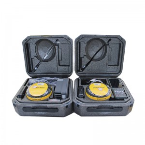
800 Channel GPS RTK Unistrong G970II Pro Survey GNSS RTK
G970II supports GPS, GLONASS, BDS, GALILEO and other systems to receive multi-frequency signals. The build-in “Lyra” baseband chip is able to provide more channels. The receiver supports “Atlas” L-Band signals and can achieve centimeter-level positioning. G970II supports GPS, GLONASS, BDS, GALILEO and other systems to receive multi-frequency signals. The build-in “Lyra” baseband chip is able to provide more channels. The receiver supports “Atlas”... -
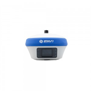
Stonex S6IIS980 Land Surveying Instrument Gnss Rover RTK
Stonex S980 integrated GNSS receiver tracks all the present constellations and satellite signals GPS, GLONASS, BEIDOU, GALILEO, QZSS and IRNSS. Through the 4G GSM modem a fast internet connection is guaranteed and the Bluetooth and Wi-Fi modules allow always reliable data flow to the controller. These features combined with the integrated 2-5 watt radio make S980 the perfect base station receiver. The color touch display and the possibility of connecting an external antenna makes S980 an extr... -
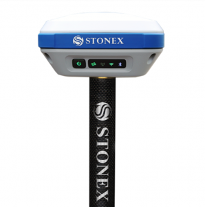
Stonex S3II GNSS receiver 555 channels GPS RTK
S3II GNSS Receiver GNSS solution for your daily surveying job Equipped with an advanced 555 channels GNSS board and capable of supporting multiple satellite constellations, including GPS, GLONASS, BEIDOU and GALILEO, Stonex S3II GNSS receiver is an ideal solution for any surveying field work. The advanced receiver design gives S3II excellent signal tracking ability and interference resistant capacity. The independent R&D LINUX+CORTEX intelligent platform provides users high performance co... -
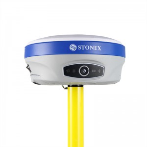
GNSS RTK System Base And Rover Station Stonex S9ii GNSS GPS
Model S9ii Satellite system Beidou+GPS+GLONASS+ Galileo Track features Channel 394 GPS L1 C/A,L2E,L2C,L5 GLONASS L1 C/A, L1P, L2 C/A(GLONASS M), L2P BDS B1,B2 GIOVE-A L1 BOC, E5A, E5B, E5AltBOC1 GIOVE-B L1 CBOC, E5A, E5B, E5AltBOC1 SBAS WASS,MSAS,ENGOS,QZSS Performance indicators Static measurement of plane precision. ±(2.5mm + 1ppm)RMS Static measurement elevation accuracy. ±(5mm + 1ppm)RMS RTK measures plane pr... -
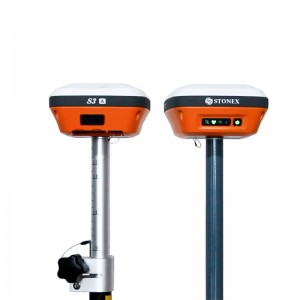
800 channels IMU tilt IP68 Atlas gnss rtk gps stonex s3a receptor base and rover
Stonex S3A IMUBeyond Imagination key features: MULTI CONSTELLATION Stonex S3 A with its 800 channels, provides an excellent on board real time navigation solution with high accuracy. All GNSS signals (GPS, GLONASS, BEIDOU and GALILEO) are included. no additional cost. WEB UI CONTROL To initialize, manage. monitor the settings of the receiver and to download data using portable or PC, smartphone or tablet with Wi-fi capability. 6800mAh BATTERY CAPACIT Stonex S3A is delivered with 6800mAh la... -

Gps Survey Equipment South Galaxy G6 GPS Surveying Instruments RTK
Specification GNSS performance Channels 336, 965 (optional) GPS L1C/A, L1C, L2C, L2E, L5 GLONASS L1C/A, L1P, L2C/A, L2P, L3 BDS B1, B2, B3 GALILEO E1, E5A, E5B, E5AltBOC, E6 SBAS L1 C/A, L5 QZSS, WAAS, MSAS, EGNOS, GAGAN L-Band Trimble RTX Positioning output rate 1Hz~50Hz Initialization time <10s Initialization reliability >99.99% Positioning precision Static surveying Horizontal: 3mm+0.1ppm RMS; Vertical: 3.5mm+0... -
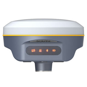
South Galaxy G2 Differential GPS Receiver South Galaxy G2 GNSS GPS RTK
Specification GNSS Features Channels 965 GPS L1, L1C, L2C, L2P, L5 GLONASS G1, G2, G3 BDS BDS-2: B1I, B2I, B3I BDS-3: B1I, B3I, B1C, B2a, B2b* GALILEOS E1, E5A, E5B, E6C, AltBOC* SBAS L1* IRNSS L5* QZSS L1, L2C, L5* MSS L-Band (Reserve) Positioning output rate 1Hz~20Hz Initialization time < 10s Initialization reliability > 99.99% Positioning Precision Code differential GNSS positioning Horizontal: 0.2... -
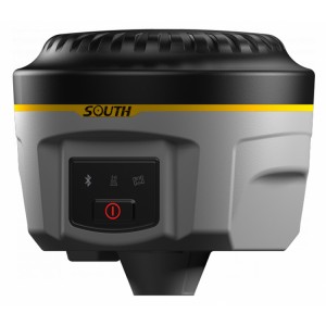
Professional Land Survey Equipment South G1 Rtk Gps Rtk Gnss Survey Instrument Rtk
SOUTH Galaxy G1 Surveying Performance Channel 800 Channels Signal Tracking BDS B1, B2, B3, GPS L1C/A, L1C, L2C, L2E, L5 GLONASS L1C/A, L1P, L2C/A,L2P, L3 SBAS L1C/A, L5( Just for the satellites supporting L5 ) Galileo GIOVE-A, GIOVE-B, E1, E5A, E5B QZSS,WAAS, MSAS, EGNOS, GAGAN, SBAS GNSS Feature Positioning output rate: 1HZ~50HZ Initialization time : <10s Initialization reliability : >99.99% Positioning Precision Code Di... -

Professional Ruide R6 336 Channels Total Station GNSS GPS RTK
Rimu Equipped
Pacific Crest BD990
336 channels
Supports all constellations
L-band correction, RTK XTRa
WiFi, Bluetooth 4.0, UHF, WCDMA
Web Server Management
Dual batteries, hot-swapping -
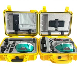
RUIDE R90i Surveying Instrument 692channels IMU Tilt RTK GPS GNSS
Pacific Peak BD970 board, has 220 channels Global Positioning System L1C/A, L1C, L2C, L2E, L5 Glonus L1C/A, L1P, L2C/A, L2P, L3 Galileo Giove-A, Jove-B, E1, E5A, E5B Bedou B1, B2 QZS, Vass, Mas, Egnos, Gagan, Bath. Free Glonus, Galileo, and Bedu have no time limit and no code to activate them. Phase fuzzy resolution algorithm, fixed solution time < 10 seconds. Measurement rate 1Hz-50Hz. RTK accuracy: 8 mm + 1ppm (level), 15 mm + 1ppm (elevation). The RIMU tilt s... -

Tilt Survey E-Bubble NFC Functions Kolida K5 Plus GPS RTK Surveying
Satellite Signal Tracked Simultaneously GPS: L1C/A,L1C,L2C, L2E, L5 GLONASS: L1C/A, L1P, L2C/A, L2P, L3 SBAS: WAAS, EGNOS, MSAS Galileo: E1, E5A, E5B (test) Beidou: B1, B2, B3 Positioning Accuracy Real Time Kinematic (RTK): Horizontal:8mm+0.5 ppm RMS Vertical:15mm+0.5 ppm RMS Initialization time:typically 2s-8s Initialization reliability : typically >99.9% Static Surveying (Post-processing): Horizontal: 2.5mm+0.5ppm RMS Vertical: 5mm+0...
