Hi Target
-

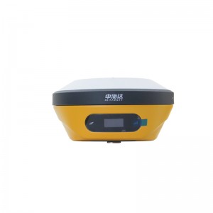
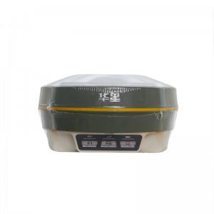
Hi Target Irtk20 Base And Rover Good Price Gnss Surveying Gps Surveying Instrument RTK
iRTK20 Technical specifications GNSS configuration Number of channels 1408 Satellite tracking BDS:B1l,B21,B3I,B1C,B2a,B2b GPS:LIC/A, L1C, L2P(Y), L2C,L5 GLONASS:L1, L2 GALILEO:E1, E5a,E5b, E6* QZSS:L1,L2,L5,L6* IRNSS:L5* SBAS:L1, L2,L5 L-BAND* Output format ASCI: NMEA-0183, binary code Positioning output frequency 1Hz~20Hz Static data format GNS,Rinex dual-format static data Difference scheme RTCM2.X,RTCM3.X Network mode VRS,FKP,MAC; Supports the NTRIP protocol ... -
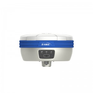
Hi-target V2 Cheap Land Surveying Equipment Gnss Price Detail Survey Instrument RTK
RTK V2 technical parameters GNSS configuration Number of channels: 800+ BDS: B1, B2, B3 GPS: L1, L2, L5 GLONASS: L1, L2 GALILIEO: E1, E5a, E5b SBAS: Support QZSS: Support Output format ASCII: NMEA-0183, binary code Positioning output frequency 1Hz~20Hz Static data format GNS, Rinex dual format static data Difference format CMR, RTCM2.X, RTCM3.0, RTCM3.2 Network mode VRS, FKP, MAC; support NTRIP protocol System Configuration operating system Linux operating system ... -
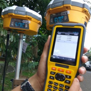
Hi Target TS5 Dual-frequency Hot Sale Electronic Bubble Calibration Gps Gnss RTK
Measurements Multi-satellites system kernel Out put frequency: 1Hz~20Hz Output format: ASCII, NMEA-0183, Binary code Channels: 660 Satellite Singnals Tracked Simultaneously GPS: L1, L2C/L2P, L5 BDS: B1, B2, B3 GLONASS: L1, L2 Accuracy Static Fast Staic GNSS Surveying Horizontal: 2.5mm+0.5ppm RMS Vertical: 5mm+0.5ppm RMS RTK Surveying Horizontal: 8mm+1ppm RMS Vertical: 15mm+1ppm RMS Initialization time <10s Initialization reliability >99.99% Hardware Ph... -

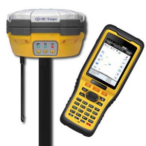
Hi Target TS7 Land Measuring Hot Sale Gnss 660 Channels Gps Dual Frequency RTK
GNSS Signal tracking Gps:L1c/a, l2c/a, l2p, l5 Glonass:L1c/a, l1p, l2c/a,l2p Bds:B1,b2,b3 Galileo:Reserved Sbas:Reserved No.Of channels 660 MEASUREMENT PERFORMANCE Initializing Time Less than 10 Seconds Real-time Kinematic Hz 8mm + 1ppm / V 15mm + 1ppm RMS Static and Fast Static Hz 2.5mm + 0.5ppm / V 5mm + 0.5ppm RMS High-precision Static Hz 2.5mm + 0.1ppm / V 3.5mm + 0.4ppm RMS DGPS Hz 0.25m + 1ppm / V 0.5m + 1ppm RMS Initialization Relia... -
Hi target V60/A10/H32 Trimble Main Board Gps Receiver RTK Surveying Equipment Cheap Price Survey Instrument Gnss Rtk
Hi Target V60 GNSS Characteristics 220 channels GPS: L1C/A,L1C,L2C, L2E, L5 GLONASS: L1C/A, L1P, L2C/A, L2P, SBAS: WAAS, EGNOS, MSAS Galileo: E1, E5A, E5B (test) Beidou: B1, B2 Advanced multipath mitigation Low noise carrier phase measurement Performance Specifications (1) Real Time Kinematics (RTK) Horizontal: 8mm+0.5ppmRMS Vertical: 15mm+0.5ppm RMS Initialization time: typically<8s Initialization reliability: typically >99.9% Post Processing Static Hor... -
Cheap Hi target V30 Gnss Rover Rtk System Gps
Hi Target V30 GNSS Characteristics 220 channels GPS: L1C/A,L1C,L2C, L2E, L5 GLONASS: L1C/A, L1P, L2C/A, L2P, SBAS: WAAS, EGNOS, MSAS Galileo: E1, E5A, E5B (test) Beidou: B1, B2 Advanced multipath mitigation Low noise carrier phase measurement Performance Specifications (1) Real Time Kinematics (RTK) Horizontal: 8mm+1ppm Vertical: 15mm+1ppm RMS Initialization time: typically<10s Initialization reliability: typically >99.9% Horizontal: 2.5mm+0.5ppm RMS P... -

Hi target V5 1408 Channel Cheap Land Surveying Equipment Gnss Price Detail Survey Instrument RTK
Station differential Support Hi-RTP satellite-based enhancement services (support L-Band) GNSS configuration number of channels:1408 BDS:B1,B2,B3 GPS:L1C/A,L2C,L2E,L5 GLONASS:L1,L2 GALILIEO SBAS output format ASCII: NMEA-0183,binary code Locating output frequency 1Hz~20Hz Static data format GNS,Rinex Dual Format Static Data Difference scheme CMR,RTCM2.X,RTCM3.0,RTCM3.2 Network pattern VRS,FKP,MAC;Support for NTRIP agreements system configuration OS Linux start tim... -
Hi Target A10/H32/V60 Trimble Main Board Gnss Dual-frequency Tilt Survey And Electronic Bubble Gps Rtk
Hi Target H32 GNSS Characteristics 220 channels GPS: L1C/A,L1C,L2C, L2E, L5 GLONASS: L1C/A, L1P, L2C/A, L2P, SBAS: WAAS, EGNOS, MSAS Galileo: E1, E5A, E5B (test) Beidou: B1, B2 Advanced multipath mitigation Low noise carrier phase measurement Performance Specifications (1) Real Time Kinematics (RTK) Horizontal: 8mm+0.5ppmRMS Vertical: 15mm+0.5ppm RMS Initialization time: typically<8s Initialization reliability: typically >99.9% Post Processing Static Hor... -
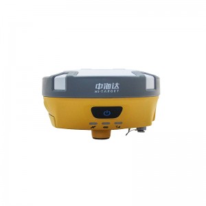
HT V90 Gnss Rtk V90 Smart GPS Receiver Rtk System
Model V90 System Configuration Data storage 8GB Internal storage (Support up to 32GB external SD card) Record GNS and RINEX format simultaneously Data Formats 1Hz positioning output, up to 50Hz CMR: CMR, CMR+, sCMRx input and output RTCM: RTCM 2.1, 2.2,2.3, 3.0, 3.1, 3.2 input and output Navigation outputs ASCII: NMEA-0183 GSV, AVR, RMC, HDT, VGK, VHD, ROT, GGK, GGA, GSA, ZDA, VTG, GST, PJT, PJK, BPQ, GLL, GRS, GBS Navigation outputs binary: GSOF Satellite Signals Tracked S... -
Hi target IRTK5 Handheld Surveying Cheap Gps Rtk With Dual Frequency RTK
Configuration Detailed indicators GNSS Configuration Satellite signals tracked simultaneously Channels:1408 BeiDou: B1, B2, B3 GPS: L1C/A, L2C, L2E, L5 GLONASS: L1C/A, L2C/A, L3 CDMA GALILEO: E1, E5A, E5B, E5AltBOC, E6 SBAS: L1C/A, L5 QZSS, WAAS, MSAS, GAGAN, IRNSS Support the PPP service Output format ASCII: NMEA-0183, binary data Positioning output frequency Maximum 50Hz Static data format GNS and Rinex Message type CMR, RTCM2.X, RTCM3.0, RTCM3.2 Network model V... -

HI TARGET H32/A10/V60 Trimble Main Board Detail Survey Gps Gnss Rtk Surveying Instrument
Hi Target H32 GNSS Characteristics 220 channels GPS: L1C/A,L1C,L2C, L2E, L5 GLONASS: L1C/A, L1P, L2C/A, L2P, SBAS: WAAS, EGNOS, MSAS Galileo: E1, E5A, E5B (test) Beidou: B1, B2 Advanced multipath mitigation Low noise carrier phase measurement Performance Specifications (1) Real Time Kinematics (RTK) Horizontal: 8mm+0.5ppmRMS Vertical: 15mm+0.5ppm RMS Initialization time: typically<8s Initialization reliability: typically >99.9% Post Processing Static Hor... -
Hi target V300 Gps Rtk Cheap Price Surveying Instrument High Performance Gnss Receiver Rtk
GNSS configuration Channel: 1408 Satellite tracking:BDS:B1I,B2I,B3I,B1C,B2a,B2b GPS:L1C/A,L1C,L2P(Y),L2C,L5 GLONASS:L1,L2 GALILEO:E1,E5a,E5b,E6* QZSS:L1,L2,L5,L6* IRNSS:L5* SBAS:L1,L2,L5 L-BAND* Output format ASCII:NMEA-0183,Binary code Positioning output frequency 1Hz~20Hz Static data format GNS, Rinex dual-format static data Difference scheme RTCM2.X,RTCM3.X Network mode VRS,FKP,MAC; Supports the NTRIP protocol System configuration Operating system Linux Opera...