High Quality for Gnss Rtk Rover - Professional Land Survey Equipment South G1 Rtk Gps Rtk Gnss Survey Instrument Rtk – Haodi
High Quality for Gnss Rtk Rover - Professional Land Survey Equipment South G1 Rtk Gps Rtk Gnss Survey Instrument Rtk – Haodi Detail:


|
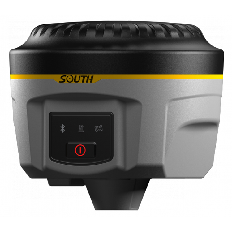
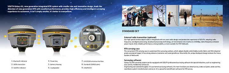
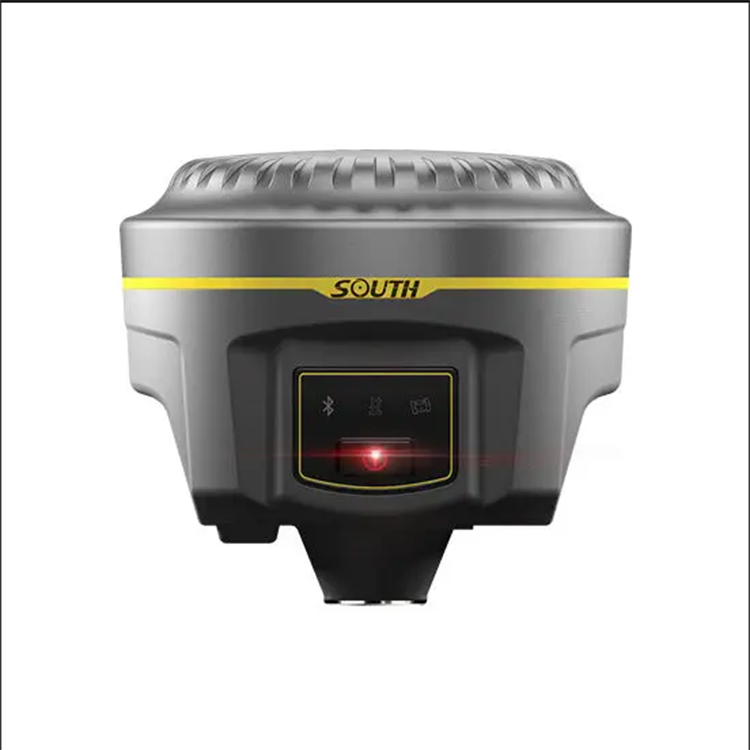
SOUTH Galaxy G1 |
|
|
Surveying Performance |
|
|
Channel |
800 Channels |
|
Signal Tracking |
BDS B1, B2, B3, |
|
GPS L1C/A, L1C, L2C, L2E, L5 |
|
|
GLONASS L1C/A, L1P, L2C/A,L2P, L3 |
|
|
SBAS L1C/A, L5( Just for the satellites supporting L5 ) |
|
|
Galileo GIOVE-A, GIOVE-B, E1, E5A, E5B |
|
|
QZSS,WAAS, MSAS, EGNOS, GAGAN, SBAS |
|
|
GNSS Feature |
Positioning output rate: 1HZ~50HZ |
|
Initialization time : <10s |
|
|
Initialization reliability : >99.99% |
|
|
Positioning Precision |
|
|
Code Differential GNSS Positioning |
Horizontal: 0.25 m + 1 ppm |
|
Vertical: 0.50 m + 1 ppm |
|
|
SBAS positioning accuracy: typically<5m 3DRMS |
|
|
Static GNSS Surveying |
Horizontal: 2.5 mm + 0.5 ppm |
|
Vertical: 5 mm + 0.5 ppm |
|
|
Real-Time Kinematic Surveying (Baseline<30km) |
Horizontal: 8 mm + 1 ppm |
|
Vertical: 15 mm + 1 ppm |
|
|
Horizontal: 8 mm + 0.5 ppm |
|
|
Vertical:15 mm + 0.5 ppm |
|
|
Network RTK |
RTK initialization time: 2~8s |
|
Physical |
|
|
Dimension |
12.9cm × 11.2cm |
|
Weigh |
970g(includiing installed battery) |
|
Material |
Magnesium aluminum alloy shell |
|
Environmental |
|
|
Operating |
-45℃~+60℃ |
|
Storage |
-55℃~+85℃ |
|
Humidity |
Non-condensing |
|
Waterproof/Dustproof |
IP67 standard,protected from long time immersion to depth of 1m |
|
IP67 standard,fully protected against blowing dust |
|
|
Shock and Vibration |
Not operating: Withstand 2 meters pole drop onto the cement ground naturally |
|
operating : Withstand 40G 10milliseconds sawtooth wave impact test |
|
|
Electrical |
|
|
Power consumption |
2W |
|
Battery |
Rechargeable, removable Litium-ion battery |
|
Battery Life |
Single battery: 7h( static mode ) 5h( interual UHF base mode ) |
|
6h( rover mode ) |
|
|
Communications and Data storage |
|
|
I/O Port |
5PIN LEOM external power port + RS232 |
|
7PIN LEOM RS232 + USB |
|
|
1 network/radio data link antenna port |
|
|
SIM card slot |
|
|
Wireless Modem |
Integrated internal radio receiver and transmitter 0.5W/2W |
|
External radio transmitter 5W/25W |
|
|
Working frequency |
410-470MHz |
|
Communication protocol |
TrimTalk450s, TrimMark3, PCC EOT, SOUTH |
|
Cellular Mobile Network |
WCDMA3.5G network communication module, GPRS/EDGE compatible, CDMA2000/EVDO |
|
3G optional |
|
|
Double Module Bluetooth |
BLEBluetooth 4.0 standard, support for android, ios cellphoon connection |
|
Bluetooth + EDR standard |
|
|
NFC communication |
Realizing close range ( shorter than 10cm ) automatic pair between Galxy G1 and controller |
|
(controller equipped NFC wireless communication module needed) |
|
|
Data storage/Transmission |
4GB internal storage, more than 3 year raw observation data (1.4M/day) base on recording from 14 satelites Plug and play more of USB data transmission |
|
Data Format |
Differential data format: CMR+, CMRx, RTCM2.1, RTCM2.3, RTCM3.0, RTCM3.1, RTCM3.2 |
|
|
GPS output data format: NMEA0813, PJK plan, cordinates binary code |
|
|
Network model support: various, FKP, MAC, supporting NTRIP protocol |
|
Intertial Sensing System |
|
|
Tilt survey |
Built-in tilt compensator, correcting coordinates automaticlly according to the tilt direction and angle of the centering rod |
|
Electornic Bubble |
Conteroller software display electronic bubble, checking leveling status of the centering rod real time |
|
User Interaction |
|
|
Buttons |
One-button operation, Visual operation, convenient and efficient |
Product detail pictures:


Related Product Guide:
abide by the contract", conforms towards the market requirement, joins during the market competition by its good quality likewise as provides additional comprehensive and great services for customers to let them turn out to be big winner. The pursue of your enterprise, is the clients' fulfillment for High Quality for Gnss Rtk Rover - Professional Land Survey Equipment South G1 Rtk Gps Rtk Gnss Survey Instrument Rtk – Haodi , The product will supply to all over the world, such as: Uruguay, Pakistan, Sacramento, With the goal of "zero defect". To care for the environment, and social returns, care employee social responsibility as own duty. We welcome friends from all over the world to visit and guide us so that we can achieve the win-win goal together.
This enterprise in the industry is strong and competitive, advancing with the times and develop sustainable, we are very pleased to have a opportunity to cooperate!
Products categories
-
Factory Free sample Laser Survey - Tribrach An...
-
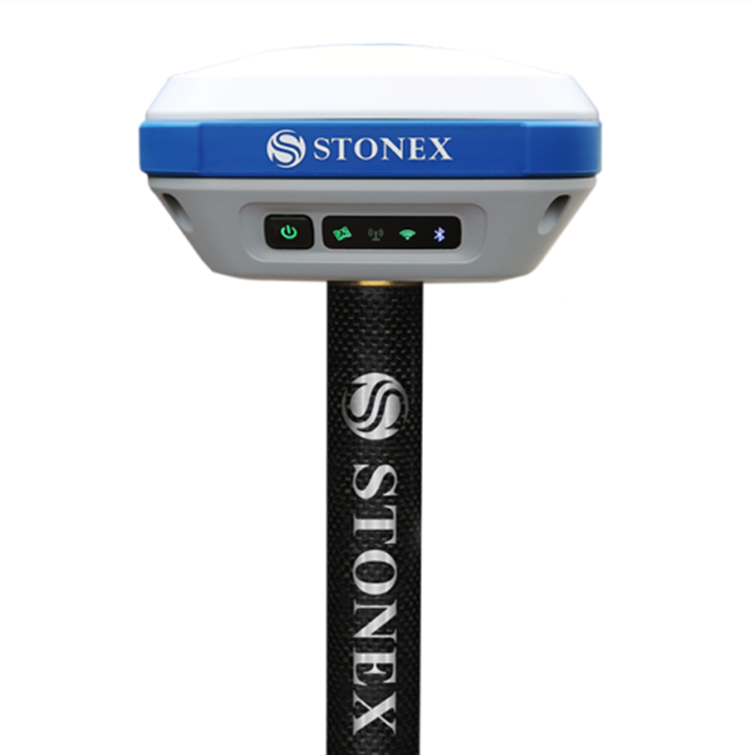
OEM/ODM Factory Gnss Rtk System Price - Stonex...
-
Super Lowest Price Gnss Rtk Price - CHCNAV IBA...
-
High reputation Drone-Professional 4k - Tribra...
-

Chinese Professional Gps Base And Rover - High...
-
Hot sale Drone Sprayer - Tribrach And Adapter ...