Products
-

-

Geomax ZT15R Pro Robotic Dual-axis For Sale Surveying Equipment Total Station
model ZT15R Pro telescope Aperture 40mm gain 30x Field of view 1°30” Shortest viewing distance 1.7m Measuring range Single prism 3000m/3500m Without prism 400m Precision 2mm+2ppm (with prism) / 3mm+2ppm (without prism) Angle measurement Angle measurement principle Absolute coding display 1”/5”/10” Precision 2” Compensator Compensation principle Integrated liquid photoelectric dual axis The scope of work ±3′ Level ... -

CHC M9 Gnss Receiver Rtk 1408 Channels Survey Equipment Base and Rover Gnss Rtk Surveying Gps Rtk
TECHNICAL PARAMETER Satellites and accuracy Satellite system GPS+BDS+Glonass+Galileo+QZSS, support Beidou three generations, support Five Star 21 frequency point Number of channels 1408 Initialization reliability 99.90% No network continued test support anti-interference Narrow band anti-jamming technology, effectively shield the internal electromagnetic interference of the host RTK accuracy Plane accuracy:±( 8mm + 1×10⁻⁶×D)mm Height accuracy:±(15mm + 1×10⁻⁶×D)mm Stati... -
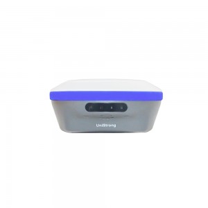
Unistrong G960SE International Version Land Measuring Instrument RTK With Upgraded Surpad Software Geodetic Equipment RTK
GNSS Channels 140 tracking GPS: L1C/A, L1C, LIP, L2C, L2P, L5 BDS: B1l, B2I, B3I, B1C, B2a, B2b, ACEBOC GLONASS: Gl, G2, G3 Galileo: El, E5a, E5b, ALTBOC, E6 QZSS: L1C/A, L1C, L2C, L5, LEX SBAS static accuracy H:± (2.5+0.5 X 10⁻⁶D)mm V:± (5 + 0.5 X 10⁻⁶D) mm RTK accuracy H:±(8 + 1 X 10⁻⁶D)mm V:± (15+1 X 10⁻⁶D)mm ± (8+0.3TILT)mm IMU compensation degree 0-70° configuration update rate, system 400Hz storage 8G blue tooth BT 5.0 Compatible WIFI 802.11 b/g/n comm... -

INNO7 High Accuracy Surveying Instrument GNSS Receiver Dual Frequency Gps RTK
GNSS Features Channels 1598 GPS L1C/A, L1C, L2C, L2E, L5 GLONASS L1C/A, L1P, L2C/A, L2P, L3 BDS B1, B2, B3 GALILEOS E1, E5A, E5B, E5AltBOC, E6 SBAS L1C/A, L5 (Just for the satellites supporting L5) IRNSS L5 QZSS L1C/A, L1 SAIF, L2C, L5, LEX MSS L-Band Trimble RTX[1] Positioning output rate 1Hz~50Hz Initialization time < 10s Initialization reliability >99.99% Positioning Precision Code differential GNSS positioning Horizontal: 0.25 m + 1 ppm RMS Vertical... -

Lei ca TM60 High Accuracy 0.5” Magnification 30x Total Station Robotic Circular Prism 3000m Total Station
TM60 Technical Parameters Angle measurement Accuracy (Hz and V) Absolute coding, continuous, quadruple shafting compensation 0.5”(0.15mgon)OR 1”(0.3mgon) Distance measurement Range Prism (GPRI.GPHIPP/ Long Range mode) 0.9m to 3500m /12000m No prism/any surfaces 0.9m to >1000 m Accuracy/measurement time Single prism 0.6mm+1ppm/ typical 24 seconds Single time (any surface) 2mm+2ppm/ Typical 2 seconds Spot size 50m 8 mm x 20 mm Measurement technique System ana... -
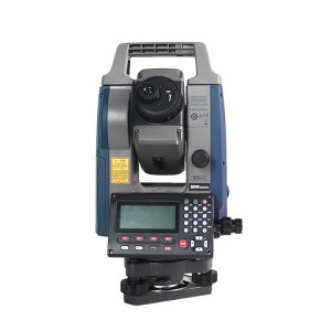
Japan Brand Sokkia IM52 Land Survey Cheap Price Surveying Robotic Total Station
MODEL iM-52 iM-55 Telescope Magnification / Resolving power 30x / 2.5” Others Length : 171mm (6.7in.), Objective aperture : 45mm (1.8in.) (48mm (1.9in.) for EDM), Image: Erect, Field of view: 1°30’ (26m/1,000m), Minimum focus: 1.3m (4.3ft.) Reticle illumination: 5 brightness levels Angle Measurement Minimum Display (selectable) 1″/5″ (0.0002 / 0.001gon, 0.005 / 0.02mil) Accuracy (ISO 17123-3:2001) 2” 5” Dual-axis compensator Dual-axis liquid tilt sensor, worki... -
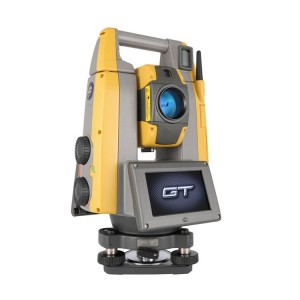
Japan brand GTS-1201 Non Reflective Mirror Low-priced Remote Portable High Quality Total Station
Technical index Model GT-1201 GT-1202 Automatic tracking/automatic sighting Automatic tracking optional autocollimation Drive mode ultrasonic motor drive Maximum speed/maximum automatic tracking speed 180°/ SEC /20°/ SEC Automatic tracking automatic collimation range 360-prism ATP1/ATP15³:2 ~60Cm Small rod prism R1PA/ Prism 5:1.3 ~ 500m Standard single prism AFO1AR/ Prism 2:1.3 ~ 1000m Reflector (white moving sight) “:RS10/30/50... -
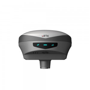
Hi Target Irtk20 Base And Rover Good Price Gnss Surveying Gps Surveying Instrument RTK
iRTK20 Technical specifications GNSS configuration Number of channels 1408 Satellite tracking BDS:B1l,B21,B3I,B1C,B2a,B2b GPS:LIC/A, L1C, L2P(Y), L2C,L5 GLONASS:L1, L2 GALILEO:E1, E5a,E5b, E6* QZSS:L1,L2,L5,L6* IRNSS:L5* SBAS:L1, L2,L5 L-BAND* Output format ASCI: NMEA-0183, binary code Positioning output frequency 1Hz~20Hz Static data format GNS,Rinex dual-format static data Difference scheme RTCM2.X,RTCM3.X Network mode VRS,FKP,MAC; Supports the NTRIP protocol ... -
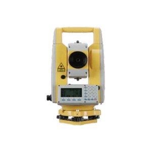
Good Price Total Station NTS-362R10 Reflectorless 1000m Surveying Instrument Total Station
Model NTS-362R10 Distance Measurement (with cooperation target) Range Measurement Single Prism:5000m Reflective Sheet (60mm*60mm):1000m Accuracy +(2mm+2X10⁻⁶·D) Measure Time Precision measurement 0.3 seconds/tracking 0.1 seconds Mirror-free Distance Measurement (no cooperating target) Range (Kodak White, 90% reflectivity) 1000m Accuracy +(3+2X10⁶·D)mm Measure Time 0.3~3 seconds Angle Measurement Angle Measurement Method Absolute coded angle measurement technolo... -
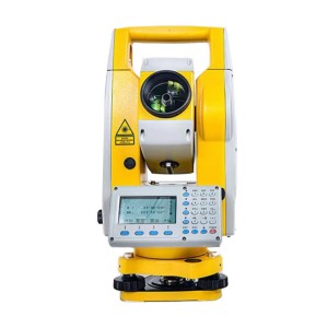
NTS-332R10 Reflectorless Total Station Surveying Equipment Single Prism 5000mTotal Station
Model NTS-332R10 Distance measurement The maximum distance (Good weather) Single prism 5000M A reflective sheet 1000M no prism 1000M Digital Display Maximum: 999999999.999 Minimum: 1MM Precision +(2mm+2*10-6·D) Accuracy 2+2PPM Mirror-free distance measurement (no cooperating target) Measuring range (Kodak gray, 90% reflectance) 1000m precision 0-300m 3+2 300-600m 5+2>600m 10+2 Mirrorless measurement time Continuous 0.35s. tracking 0.2s, single time less than 1.2s ... -
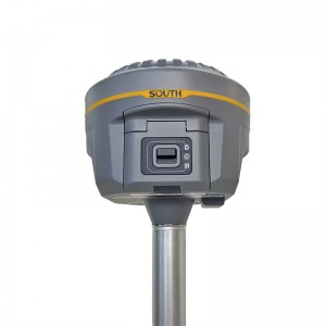
South New G1 Survey Equipment Gps Rtk Dual-frequency Intelligent Inertial Gnss Receiver
Galaxy G1 Surveying Performance Channel 1598 Channels Signal Tracking BDS B1, B2, B3, GPS L1C/A, L1C, L2C, L2E, L5 GLONASS L1C/A, L1P, L2C/A,L2P, L3 SBAS L1C/A, L5( Just for the satellites supporting L5 ) Galileo GIOVE-A, GIOVE-B, E1, E5A, E5B QZSS,WAAS, MSAS, EGNOS, GAGAN, SBAS GNSS Feature Positioning output rate: 1HZ~50HZ Initialization time : <10s Initialization reliability : >99.99% Positioning Precision Code Differential GNSS Positioning Horizontal: ...
